| |
|
 |
 |

|
I T N L |
The Etruscan Coast, the Gulf of Baratti [1]
|
|
![Toacana ] Galleria di immagini](../../titels/albump.gif) |
|
| |
 |
|
|
| |
|
The Etruscan Coast, the Gulf of Baratti
|
|
|
|
| |
|
The Gulf of Baratti takes its name from the town of Baratti, located at the southern end, near which there are characteristic Etruscan burial mounds. The bay measures about one by one and a half kilometers and is surrounded by numerous archaeological sites from both the Etruscan and Roman times, united in the Parco Archeologico di Baratti e Populonia.
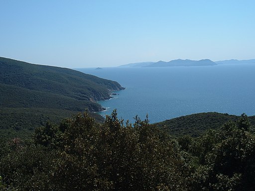
Populonia, in ancient times was one of the largest and most important Etruscan and Roman cities. The ancient town is located in a dominant position on one of the promontories that form the Gulf of Baratti.
|
 |
Golfo di Baratti, seen from Populonia [2]
|
Baratti and Populonia Archeological Park
The Archaeological Park of Baratti and Populonia is located in the township of Piombino (Province of Livorno) and covers about 80 hectares between the slopes of the promontory of Piombino and the Gulf of Baratti coast. It is part of The Parks of Val di Cornia and was opened in 1998 for visitors to view some of the archaeological sites and remains found in the new digs archaeological conducted in the area since 1996.
The park includes several areas from the ancient Etruscan city of Populonia, the necropolis of San Cerbone, Casone and the grotto, and the cave of calcarenite. Inside the park is an experimental archeological laboratory.
|
 |
Populonia Necropoli di San Cerbone, tomba
|
There are currently several proposed routes:
- San Cerbone necropolis, with tombs from the 7th-6th century BC;
- the "Via delle Cave": from fields of the Arpa, a path leading to Etruscan cave of calcarenite (or stone bench), with tombs carved into the rock of the necropolis from the 4th-3rd BC
- the "Via del Ferro" a path along the coast with the experimental archeology laboratory, which offers a glimpse into the industrial districts of the city, where housing buildings for the manufacture of iron can be found dating from the (6th-3rd century BC);
nature trails along the edge of the Caves.
In 2007 a third area of the park was opened, the acropolis, which is located at the Castle in upper Populonia and includes remains from the most ancient Etruscans, up to the Romans.
|
 |
View over the Baratti and Populonia Archeological Park from the edge of the heights. The Bay of Baratti is visible on the left (sign on the hillside above the Necropoli delle Grotte" at Populonia) [1]
|
Bibliography
- Andrea Semplici, Parco Archeologico di Baratti e Populonia. Percorsi di visita per conoscere un territorio, Firenze, Edizioni Polistampa, 2000
|
|
|
|
| |
|
|
|
| |
|

Il Golfo di Baratti e Populonia | Photo Gallery
|
 |
|
 |
|
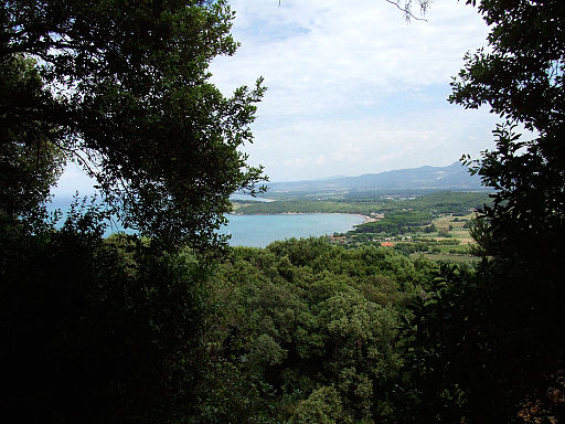 |
| Golfo di Baratti, vista da Populonia |
|
Il golfo di Baratti, il porto di Baratti
|
|
Il golfo di Baratti, vista da Populonia |
 |
|
 |
|
 |
La Costa degli Etruschi, il golfo di Baratti
|
|
Golfo di Baratti
|
|
Golfo di Baratti, pineta
|
 |
|

|
|
 |
| Populonia, Necropoli delle Grotte |
|
Populonia, Necropoli di San Cerbone, tomba
|
|
Populonia, Acropolis |
 |
|
 |
|
 |
Via dei Cavalleggeri
|
|
Baratti, Capella San Cerbone |
|
Baratti, Capella San Cerbone |
Campigilia Marittima
|
|
|
|
|

|
|
 |
|
 |
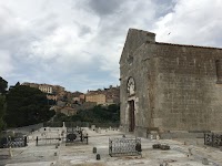
Cimitero di Campiglia Marittima
|
|
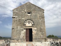
Cimitero e Pieve di San Giovanni (Campiglia Marittima) |
|
Pieve di San Giovanni (Campiglia Marittima), facciata
|

[1] Foto di LigaDue, licenziato in base ai termini della licenza Creative Commons Attribution 3.0 Unportedale.
[2] Foto di Luca Aless, licenziato in base ai termini della licenza Creative Commons Attribution 3.0 Unportedale.
|

|


Podere Santa Pia is an authentic farmhouse that dominates one of the most beautiful setting that nature can offer, the countryside in the Tuscan Maremma. Podere Santa Pia is the perfect spot to slow travel. Waking up at dawn to start hiking, learning once again the names of flowers and trees, and above all, having the pleasure of getting lost, forgetting about guides, clocks and timetables.
The most interesting artistic, historical and cultural sites of southern Tuscany are nearby, and are awaiting your discovery.
Case vacanza in Toscana | Podere Santa Pia
|
|
|
|
|
 |
|
|
Colline sotto Podere Santa Pia |
|
|
| |
|
|
|
|
Golden light at Podere Santa Pia
|
|
|
 |
#poderesantapia Il nostro giardino. Insieme ai vigneti e agli uliveti, i cipressi sono l'elemento simbolo del paesaggio toscano
|
Questo articolo è basato parzialmente sull'articolo sull'articolo Campiglia Marittima dell' enciclopedia Wikipedia ed è rilasciato sotto i termini della GNU Free Documentation License. |
|
|
| |
|
|
|
| |
|
|
|
| |
|
|
|
| |
|
|
|
| |
|
|
|
| |
|
|
|
|