| |
|
 |
 |
|
E N G |
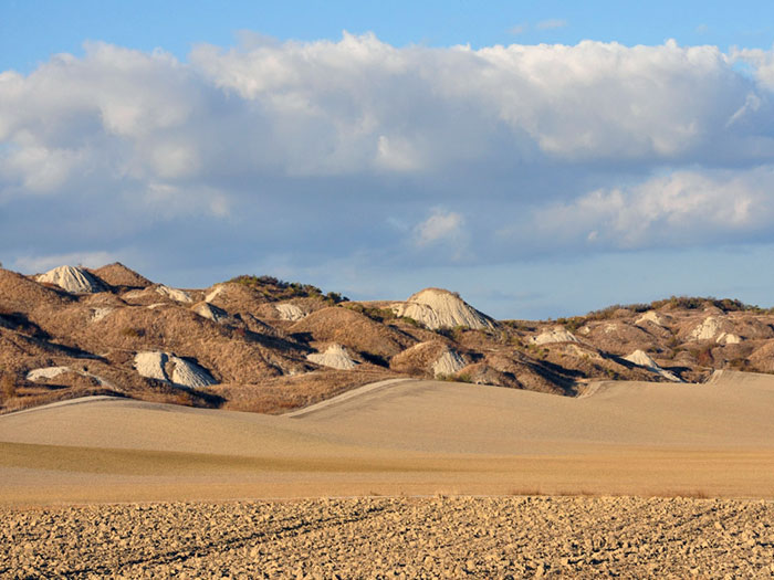
Biancane tussen Leonina en Vescona, Crete Senesi, Asciano [1]
|
|
![Toacana ] Galleria di immagini](../../../titels/albump.gif) |
|
| |
 |
|
|
| |
|
Crete senesi | Percorso di trekking Castelnuovo Berardenga | Anello delle Biancane Leonina
|
|
|
|
| |
|
Podere Santa Pia ligt in het hart van de Toscaanse Maremma, een prachtig heuvelachtig landschap waar de erfenis van de Etrusken zich verbindt met de schoonheid van de Middeleeuwen. Veel historische steden en culturele bezienswaardigheden liggen in de directe omgeving. Ook de wandelaar komt hier goed aan zijn trekken. Het oorspronkelijke en ongerepte landschap van deze valleien zijn een paradijs voor wandelaars en mountainbikers.
De Crete Senesi liggen ten noorden van dit vakantiehuis en zijn een prachtige bestemming voor een dagtocht.
Met de auto zijn e is de SS438 naar Asciano en de SP451 naar Monte Oliveto Maggiore een ideale verkenning van dit magische maar barre landschap, dat in de middeleeuwen bekend stond als de Accona-woestijn.
Biancane in the Crete Senesi
Deze suggestieve wandeling omvat verschillende hoogtepunten van de Crete Senesi in Asciano. Het Castello di Leonina, gelegen aan de weg naar Taverne d'Arbia, was vroeger een adellijk herenboerderij. Het 13e-eeuwse kasteel biedt nog steeds een spectaculair uitzicht op de witte aride kalksteenheuvels van de biancane van Leonina, met kleuren en licht die van uur tot uur en in elk seizoen anders zijn.
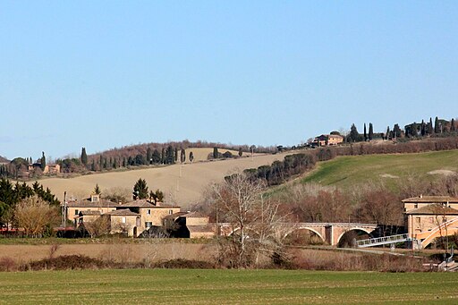
April is een ideale periode om deze streek te verkennen. De heuvels kleuren dan onwerkelijk groen, de temperaturen zijn nog mild en zacht, slingerende strade bianche, golvende graanvelden en alleenstaande cipressen genereren dan de iconografische beelden die Toscane beroemd hebben gemaakt. Tijdens de zomermaanden maak je de wandeling bij voorkeur in de vroege ochtend, als de tempa-eratuur nog mild is, en de sfeervolle ochtendmist langzaam verdwijnt en plaats maakt voor unieke prachtige vergezichten.
|

|
| Nebbia mattutina nelle Crete senesi nei pressi di Vescona, Siena [2]
|
Site Transitoire
Halverwege de wandeling ontdekken we op een kruising van oude paden de Site Transitoire, een magische plek.
Van bij de start tot het einde van de wandeling openen zich uitzonderlijke panoramische uitzichten op de Biancane di Leonina, kale heuvels zonder enige begroeiing die soms lijken op een grijs maanlandschap.
Meer informatie over de biancane en wandelroutes in de Crete Senesi vind je hier.
|
 |
| Jean Paul Philippe, Site Transitoire, 1993, posto magico nelle crete senesi, Asciano [2] |
| |
|
|
|
| |
|
|
Mappa Anello delle Biancane Leonina
|
|
|
| |
|
This evocative itinerary covers all the highlights of the Crete in the Municipality of Asciano and offers spectacular views of the clay hills with colors and light changing from hour to hour, and from season to season.
The itinerary starts in Castelnuovo Berardenga Scalo, an alienated station several kilometers from the historical center of Castelnuovo Berardenga or any other village. Here you can park your car or you can take advantage of local trains.
Going back along the asphalt road, take the small dirt road on the right that leads you in a light and constant ascent towards "Casanuova alla Stazione" and then on the ridge that leads us to overcome on our right the brick furnace and the adjacent quarry. Continuing on the ridge we arrive at Mucigliani where an exceptional panoramic view opens up on the Crete Senesi, and the Biancane di Leonina.
|
 |
Crete senesi | Anello delle Biancane Leonina Mucigliani C.Berardenga scalo [2]
|
Download gpx here
Lenghth: 17,67 km | 3,5 hours circa
Total climb 369 m
Total descent 369 m
Castelnuovo Berardenga Scalo is eenvoudig per terin te bereiken.
Linea 134R Castelnuovo Berardengan| Autolinee Toscane (ex TIEMME)
Siena Porta Ovile to Castelnuovo Berardenga | Line 7
Meer informatie (It) ook op www.travelingintuscany.com
There is a shorter track around the Leonina Lake, starting at the Parking at the SS Lauretana, Anello tra i calanchi e le biancane di Castello Leonina (Asciano).
|
|
| |
Een derde variant is 12 km lang en voert je langs de kleine meren, de laghetti van Santa Caterina en Menchiari.
Download gpx here
Lenghth: 12,66 km, about 2,5 hours
Total climb 270 m
Total descent 270 m
|
Deserto di Accona of Accona-woestijn
De Deserto di Accona is het specifieke landschap wordt gekenmerkt door calanchi en koepelvormige formaties die plaatselijk bekend staan als biancane (afgeleid van de Italiaanse bianco, wit, vanwege hun lichte schaduw) of mammeloni.
Dit gebied, bekend in de middeleeuwen als de Accona-woestijn, ligt in het hart van de Crete senesi, naast de abdij va Monte Oliveto Maggiore.
|
 |
Deserto di Accona, veduta del versante dal bivio tra Leonina e Mucigliani [3]
. |

|
|
|
 |
|
 |
|
 |
| |
|
Crete Senesi (laghi tra Castello Leonina e Vescona, Crete Senesi, Asciano)
|
|
Paesaggio tra le Crete senesi e la Val d'Orcia |
 |
|
 |
|
 |
Crete Senesi presso Asciano
|
|
Deserto di Accona |
|
Biancane nelle Crete Senesi vicino a Monte Oliveto Maggiore |
 |
|
 |
|
 |
Monteroni d’Arbia, ancient Mill of Santa Maria della Scala Siena in the center of the city
|
|
Church San Giovanni Battista a Corsano, Ville di Corsano, hamlet of Monteroni d’Arbia |
|
Ponte d'Arbia, frazione di Buonconvento
|
 |
|
 |
|
 |
Anello tra i calanchi e le biancane di Castello Leonina (Asciano)
|
|
Jean Paul Philippe, Site Transitoire, 1993, Asciano |
|
View on the calanchi, from Chiusure of the gully side just upslope of Monte Oliveto
|

De badlands van Toscane | Calanchi e biancane | Un tesoro della natura
Het unieke landschap van de Crete Senesi`
Crete Senesi | Biancane nelle Crete Senesi
Trekking in Toscana | The Via Francigena
Siena - Ponte d'Arbia - Buonconvento | Via Francigena | 26 km - 5 km
Buonconvento - San-Quirico-d'Orcia | Via Francigena | 17 km
From Siena to Buonconvento, the Via Francigena is more or less parallel to the Siena – Grosseto railway line, with useful stops in Ponte a Tressa, Monteroni d'Arbia and Buonconvento. You can return to Siena by public transport (train or Tiemme busses).
Bus | Tiemme SpA | www.tiemmespa.it
Trains | Trains from Buonconvento to Siena - Trainline.eu
First train departs at 05:54 - Last train departs at 21:00
Buonconvento - Abbazia Monte Oliveto Maggiore | 11.60 km | gpx
From Montalcino to Buonconvento | 16 km | 3 hours circa
Montalcino - Buonconvento - Abbazia Monte Oliveto Maggiore | 27 km | 5,5 hours circa

Vakantiehuizen in Toscane 
Podere Santa Pia is a beautiful stone farmhouse only 2 km away from Castiglioncello Bandini. The main house is spacious, comfortable and well furnished and offers its guests a breathtaking view over the Maremma hills. Podere Santa Pia is surrounded by a backdrop of hills and macchia mediterranea: wild, untamed and completely natural vegetation, wonderful for walking and exploring on a variety of different terrain with fantastic views everywhere you turn.
Traveling in Tuscany| Holiday homes in southern Tuscany | Podere Santa Pia
|
|
|
|
|
|
| |
|
|
|
 Follow us on Instagram Follow us on Instagram
|
 |
|
 |
|
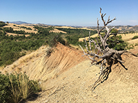 |
Castiglioncello Bandini, Calanchi nella valle tra Podere Santa Pia, Federano e il torrente Rancida
|
|
Calanchi nella valle sotto Podere Santa |
|
Calanchi nella valle sotto Podere Santa |
| |
|
|
|
|

[1] Foto di Rein Ergo. All rights reserved © Traveling in Tuscany
[2] Tratta dal sito www.caivaldarnosuperiore.it
The Crete senesi | Main sights
|
|
|
|
| |
|
|
|
| |
|
|
|
| |
|
|
|
| |
|
|
|
| |
|
|
|
| |
|
|
|
|