| |
|
 |
 |
|
Brief itinerary exploring the Mediterranean macchia and calanchi in the valley between Podere Santa Pia and Cinigiano [1]
|
|
 |
|
| |
 |
|
|
| |
|
Trekking in southern Tuscany | Brief itinerary exploring the Mediterranean macchia and calanchi in the unspoilt valley below Castiglioncello Bandini
|
|
|
|
| |
|
Podere Santa Pia is an authentic holiday home surrounded by a backdrop of hills in the Tuscan Maremma. The horizons are open and the look is lost in rural Tuscany, through beautiful vineyards, olive groves, and the wild and untamed macchia mediterranea, completely natural vegetation, wonderful for walking and exploring.
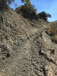
This brief itinerary starts and ends at the gate of the castle in Castiglioncello Bandini. It explores the Mediterranean macchia and calanchi in the valley below the borgo and Podere Santa Pia. Old ruins, a particular hunting chair and the impressive declining grounds of the calanchi, it all offers a great experience. The roads and the paths going through this wild area give the visitor the opportunity to see sceneries of unexpected beauty.
The tour is not difficult except for the last track (just before half way) where you leave the road towards the hunting chair, continuing on a small ridge of red grounds.
Lenghth: 9.31 km, 2 hours
Easy, except for the track halfway
Lunghezza sentiero 9,31 km - ↑ Total climb 376 m ↓ Total descent 376 m
Download gpx tracks | gpx
Map and gpx
|
|
The property of Podere Santa Pia lies on a hill overlooking the Valle d’Ombrone, a beautiful and miraculously intact valley. This part of southern Tuscany, known as the Maremma, is a wonderfully peaceful and very beautiful unspoiled area, ideal for a quiet holiday. Castiglioncello Bandini is a small borgo on the edge of the Poggio all'Olmo Nature Reserve. Several itineraries in the area make this village a good starting point to explore hills and valleys between Monte Amiata and the Valle d'Ombrone.
This brief itinerary is not difficult except for the track just before halfway, where you leave the road towards the hunting chair, continuing on a small ridge of red grounds.
Before taking off we walk around the village. La Rosa dei Venti is an excellent osteria to have lunch.
|
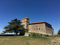
Starting point Castle of Castiglioncello Bandini
|
 |
Castiglioncello Bandini, the castle Castiglion del Torto
|
|
|
|
| |
|
| |
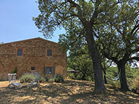
The cypresses of Podere Santa Pia
|
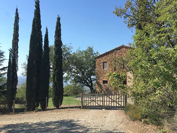 |
The gate and cypress trees at Podere Santa Pia (3,8 km) [1]
|
|
|
| |
|
You can divide this itinerary into two tracks.
Through the woods to Castiglioncello Bandini | gpx
Starting Point, the cypresses of Podere Santa Pia or the Castle of Castiglioncello Bandini
Lenghth: 6 km, 1 hour 55 minutes
Easy | 227 m upwards, 227 m downwards
Brief itinerary exploring the Mediterranean macchia and calanchi in the valley between Podere Santa Pia and Cinigiano | gpx
Circular Trail | Starting Point, the cypresses of Podere Santa Pia
Lenghth: 3,85 km, 1 hour 20 minutes
From Castiglioncello Bandini through the woods to Podere Santa Pia
|
|
|
Itinerary exploring the Mediterranean macchia and calanchi in the valley between Podere Santa Pia and Cinigiano
|
|
More details here
|
|
|

Castiglioncello Bandini album
|
|
|
 |
|
|
|
 |
Castiglioncello Bandini, Castiglion del Torto
|
|
Casa Vacanze Podere Santa Pia
|
|
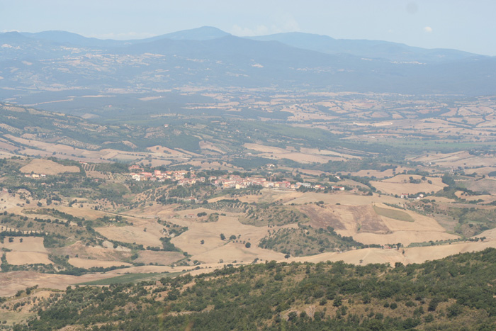
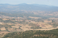
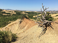
Cinigiano, view from Castiglioncello Bandini
|
 |
|
 |
|
 |
Castiglioncello Bandini album
|
|
Castiglioncello Bandini |
|
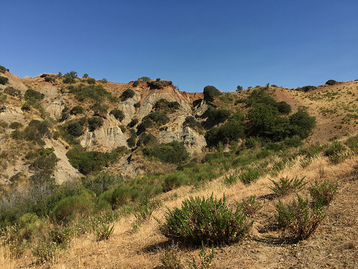
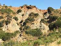
Castiglioncello Bandini, Calanchi in the valleybeween Podere Santa Pia, Federano and the torrent Rancida
|
Calanchi
|
|
|
|
|
 |
|
 |
|
 |
| |
Calanchi in the valley below Santa Pia
|
|
Calanchi nella valle sotto Podere Santa |
| |
|
|
|
| |
|
|
|
| |
|
|
|
|
| |
#poderesantapia
Una lenta passeggiata lungo le strade bianche. Podere Santa Pia si trova vicino a Castiglioncello Bandini,
immersi nella campagna Toscana.
|

Tuscany | Calanchi e biancane | Un tesoro della natura
Walking in southern Tuscany | Itineraries exploring Castiglioncello Bandini and the Mediterranean macchia in the valleys around the village
Brief itinerary exploring the Mediterranean macchia and calanchi in the valley between Podere Santa Pia and Cinigiano
Circular Trail | Starting Point, the cypresses of Podere Santa Pia
Lenghth: 3,85 km, 1 hour 20 minutes
Easy, except for the track halfway
Through the woods to Castiglioncello Bandini
Starting Point, the cypresses of Podere Santa Pia or the Castle of Castiglioncello Bandini
Lenghth: 6 km, 1 hour 55 minutes
Easy | 227 m upwards, 227 m downwards
From Podere Santa Pia (Castiglioncello Bandini) to Cinigiano
Lenghth: 8,34 km
Easy
Hiking along the Rancioa riverbed, in the hidden valleys below Castiglioncello Bandini
Circular Trail | Starting Point, the cypresses of Podere Santa Pia
Lenghth: 4,42 km, 1 hour 31 minutes
Easy, except for the essential part of the track beyond Podere Federano, where you reach and follow the Rancioa riverbed
Aree naturali protette della Toscana | Riserva Naturale Poggio all'Olmo

[1] Foto di Rein Ergo. All rights reserved © Traveling in Tuscany
|
|
|
| |
|
|
|
| |
|
|
|
| |
|
|
|
| |
|
|
|
| |
|
|
|
| |
|
|
|
|