![Toacana ] Galleria di immagini](../../titels/albump.gif)

Tombolo di Feniglia | La Riserva naturale Duna Feniglia |
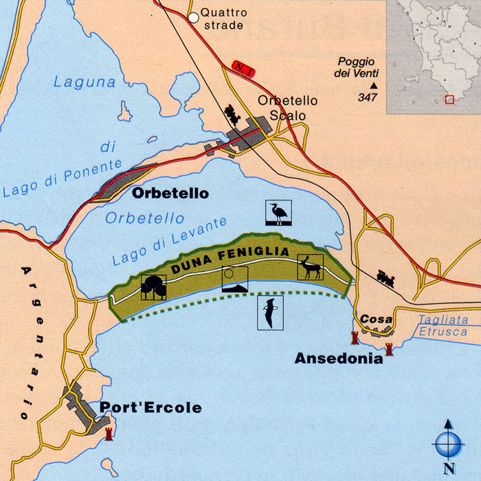
La Feniglia, situated in the municipality of Orbetello, in the province of Grosseto, is a sandbar linking the Ansedonia hill to the east and Monte Argentario to the west. It stretches for approximately 6 km in length and covers a total area of 474 hectares.
|
|
La pineta della Riserva naturale Duna di Feniglia, Orbetello [2]
|
Access Access is free on foot and by bicycle and is facilitated by a road suitable for lorries that runs the entire length of the reserve, approximately 6 km. Along the road, at intervals of approximately 1 km, there are milestones and information panels indicating the sea access points leading to the beach. The Duna Feniglia Nature Reserve is a state-protected natural area established in 1971. History In 1610, the renowned painter Michelangelo Merisi da Caravaggio, known as Caravaggio, arrived from Naples, disembarking first at Palo and then at Porto Ercole; on the run from the law, he took refuge amongst the unhealthy marshes and thickets of the Feniglia, where he met his end, succumbing to deprivation and malarial fevers. A commemorative stele has been erected, on the initiative of the Maremma Historical Society, not far from the current Forestry Corps post, the site where the dying Caravaggio is believed to have been found. Until the 1700s, the Feniglia was entirely covered in woodland, predominantly consisting of species typical of the Mediterranean scrub. In 1804, the Municipality of Orbetello, which at that time owned the land, proceeded to sell La Feniglia to private individuals, who began to use it intensively and excessively as pastureland and a source of timber. This haphazard exploitation of the land led to deforestation: the disappearance of the vegetation left the dune exposed and devoid of mountainous shelter, triggering a rapid process of erosion, mainly due to the climate, the winds and human activity. Under the influence of the libeccio wind, the sand began to shift south-eastwards, that is, from the sea towards the lagoon, which began to silt up, leading to the formation of pools of water and marshes that created conditions conducive to malaria. At the time, the lagoon was a primary resource for Orbetello, thanks to its importance to the fishing industry. Furthermore, the conditions conducive to malaria were a major cause for concern for the local council. An initial remedy involved the construction of outlet channels from the lagoon to the sea. In 1910, land was expropriated; La Feniglia became part of the State Forestry Estate and the area was reforested: various species were planted, including maritime pine, Italian stone pine and a number of suitable herbaceous species. Over the following 50 years, these measures led to the creation of a woodland covering approximately 460 hectares, of which 320 hectares consist of Italian stone pine forest and 124 hectares of protective pine forest, whilst the remainder comprises broad-leaved trees and small plots yet to be reforested. In 1971, by decree of the Ministry of Agriculture and Forestry, the Feniglia dune was declared a Protected Forest Reserve in recognition of the important functions it performs.
|
|
Pineta di Feniglia, la pista camionabile e ciclabile della riserva Feniglia [2]
|


 |
||||
Trekking in Toscana| Tombolo di Feniglia, la Duna di Feniglia |
||||
Walking at the Feniglia Sand Dune | Nature trail through the pine forests and sand dunes of Feniglia.
|
Map Tombolo Feniglia
Tombola di Feniglia, vista da |
|||
|
View Tombolo di Feniglia in a larger map |
||||
Photogallery Tombolo di Feniglia and Cosa
|
||||
 |
 |
 |
||
Anello Tombola di Feniglia, la Riserva naturale Duna Feniglia
|
La porta di Cosa
|
Tombolo di Feniglia, seen from Porto Ercole
|
||
 |

|
 |
||
Oasi Orbetello, Laguna di Orbetello
|
Tombolo di Giannella, vista da Monte Argentario
|
Orbetello visto dalla laguna di Ponente
|
||
 |
 |
 |
||
Orbetello, Laguna di Levante, in fondo la pineta di Feniglia e Cosa
|
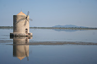
Orbetello, Il Molino Spagnolo
|
Orbetello
|
||
 |
 |
 |
||
Orbetello, La Laguna di Ponente
|
Orbetello, pescatore nella laguna di Orbetello
|
Tramonto meraviglioso, Laguna di Orbetello
|
||
|
View Tombolo di Feniglia in a larger map |
||||
Galleria fotografica Tombolo di Feniglia, Cosa, Spiaggia e Torre della Tagliata
|
||||
 |
|
 |
||
Cosa, porta
|
La porta di Cosa
|
Vista da Cosa verso la costa di Vulci
|
||
|
 |
 |
||
La porta di Cosa
|
Capitolium - front, Cosa
|
Cosa. Gate - west north
|
||
 |
 |
 |
||
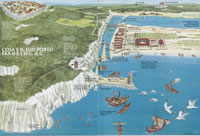
Map of Cosa, second century BCE
|
Cosa, celle
|
Casa si Diana
|
||
 |
 |
 |
||
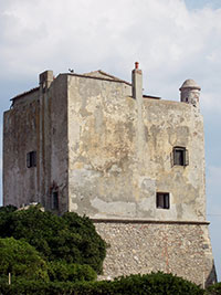
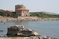
Ansedonia, Torre e forte della Tagliata [1]
|
Torre della Tagliata | Spiaggia e Torre della Tagliata | ||
The Ramsar Convention on Wetlands
www.wwf.it | Riserva Naturale dello Stato Lago di Burano (it)
|
||||
| Riserva Naturale della Laguna di Orbetello (Grosseto) | Environment, Flora and Fauna in the Orbetello Lagoon Nature Reserve Laguna di Orbetello La Riserva naturale regionale di Orbetello occupa una superficie di 1553 ettari, tutti compresi all’interno del Comune di Orbetello. Al suo interno anche il bosco di Patanella e le pertinenze di Casa Giannella, conosciute come Riserva naturale statale di popolamento animale Laguna di Orbetello, gestita dal Wwf Italia. La sua flora è costituita da una pineta litoranea (pini marittimo e domestico) e da vegetazione sclerofillica con ginepro fenicio e coccolone, filliree, alaterno, smilace, lentisco e mirto, leccio, sughera con orniello e roverella. La fauna ornitica rappresenta la componente più importante della riserva ed è rappresentata da specie la cui comparsa è del tutto accidentale come l’aquila anatraia maggiore e l’aquila di mare, di rilievo sono i contingenti di svassi, fenicotteri, anatre e folaghe. Superficie: 1533 ha. Perimetro: 25395 m. Superficie aree contigue: 1017 ha. Perimetro aree contigue: 26671 m. Comune di Orbetello Anno di istituzione: 1998 Superficie comprese le aree contigue: 2550 ha. Come si raggiunge La Riserva naturale Laguna di Orbetello si raggiunge dalla Statale Aurelia (carreggiata sud), imboccando, al chilometro 148, la strada segnalata dal WWF. E’ aperta dal primo settembre al 30 aprile con visite solo guidate, il giovedì, il sabato e la domenica (ore 10 e ore 14). Oasi Affiliata Capra Matilda (Grosseto) In de comune of Roccalbegna, in Cancellone and in dl comune of Semproniano, in Selvignana. Orbetello Laguna di Ponente Orbetello |
Orbetello |
|||
L’oasi di Orbetello comprende tre itinerari.
La Maremma Toscana
|
||||
| La Maremma Toscana, un film di Beppe Miceli | ||||
Foto di By Vincenzo venditti,
| ||||



The Tuscan Maremma is one of the most unique and fascinating areas of Tuscany, not yet overrun by mass tourism. It is a wild, authentic region in southern Tuscany known for its rugged coastlines, ancient traditions, and unspoiled nature. Experience the Maremma, Tuscany's natural paradise
|
||||
 |
 |
|||
Podere Santa Pia, mystic holiday home in the heart of the Tuscan Maremma
|
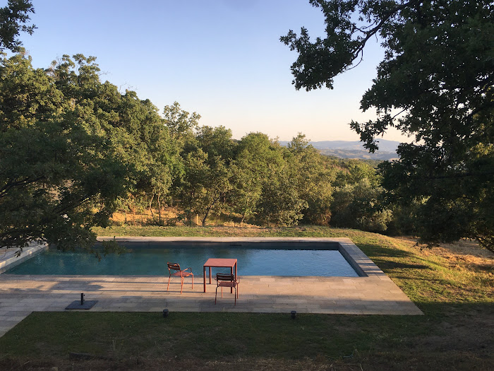
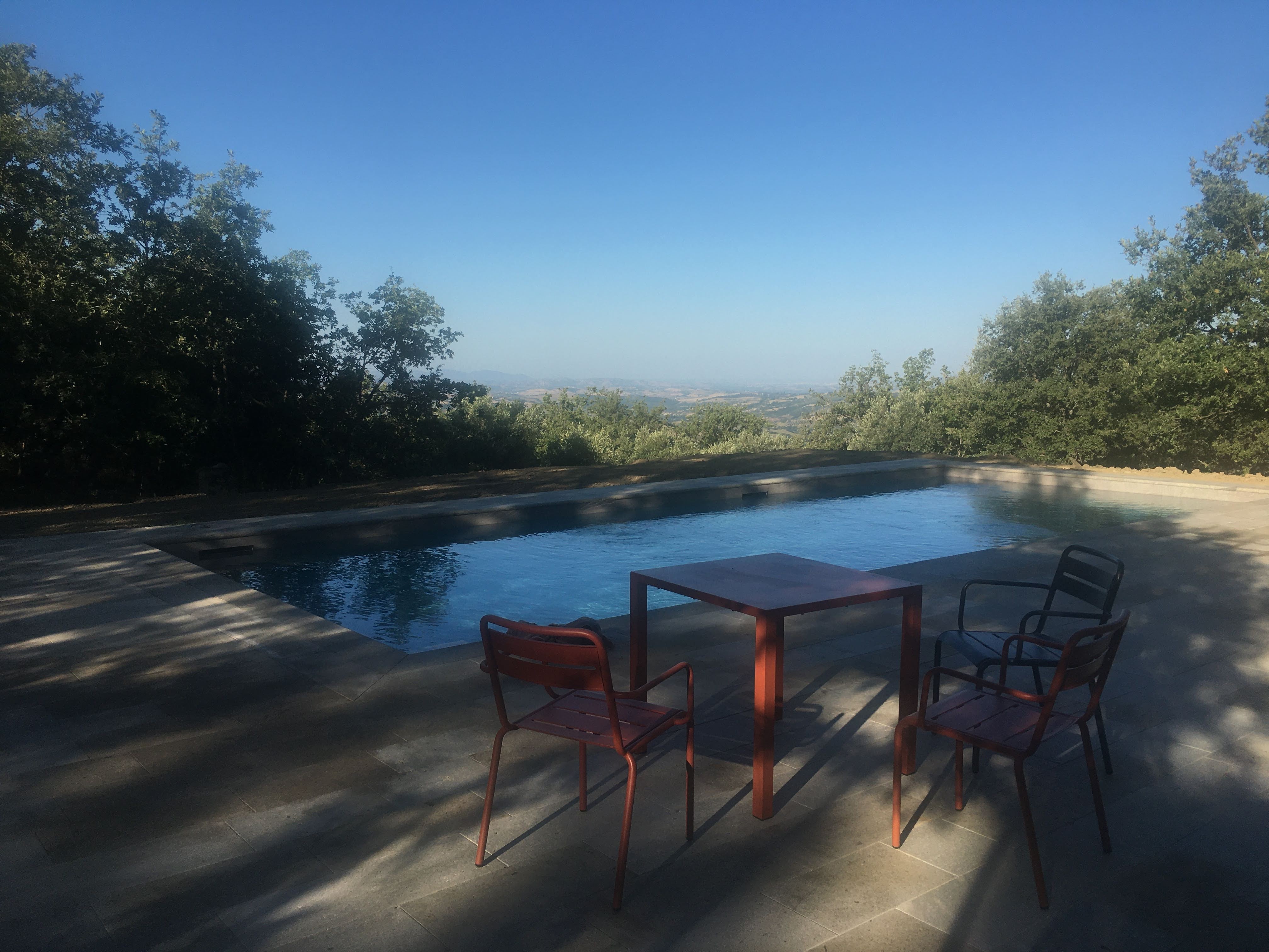
A beautiful early evening by the pool, in the resplendent Tuscan sun, time takes on a languid quality
|
Vista da Podere Santa Pia, fino al mare e Montecristo
|
||
The pool, an azure jewel nestled amidst the verdant Tuscan hills, beckoned with its shimmering waters, a siren's call to cool serenity. It was a liquid oasis, where the reflections of swaying cypress trees and fluttering butterflies merged into a dance of light and shadow.
|
||||
 |
 |
 |
||
Early morning light at the private swimming pool at Podere Santa Pia
|
A beautiful spring morning by the pool, a natural jewel nestled amidst the verdant Tuscan hill
|
The night pool at Podere Santa Pia exudes a hypnotic sense of purity
|
||
Vulci Vulci era nota nel mondo antico per i commerci, per l’artigianato e per l’agricoltura. Già attiva nell’VIII secolo a.C., nei due secoli successivi la città espanse il proprio controllo sui territori circostanti. Nel VI secolo a.C. l’artigianato locale, rafforzato dalla presenza di manodopera greca, diede vita ad una produzione di ceramiche, sculture, bronzi, di ottima fattura, che raggiunsero i mercati di tutto il mondo mediterraneo. Dopo la crisi del V secolo a.C., che non colpì gravemente Vulci, la ripresa del secolo successivo portò alla costruzione di nuove opere pubbliche come le mura e il tempio ritrovato nell’area urbana. Nella seconda metà del IV secolo a.C. Vulci cominciò a sentire il peso dell’espansionismo romano. La lotta per rimanere indipendente si concluse nel 280 a.C. quando, sconfitta, dovette cedere a Roma gran parte dei propri territori, tra cui la fascia costiera. Persa la popria autonomia la città decadde rapidamente fino a scomparire del tutto. Le necropoli
|
||||
 |
||||
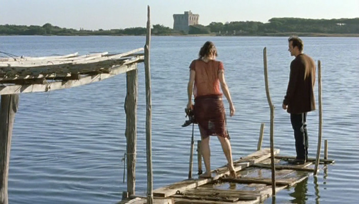
Regina Nemni and Christopher Buchholz in Michelangelo Antonion's Il filo pericoloso delle cose |
||||